- Date: July 2025.
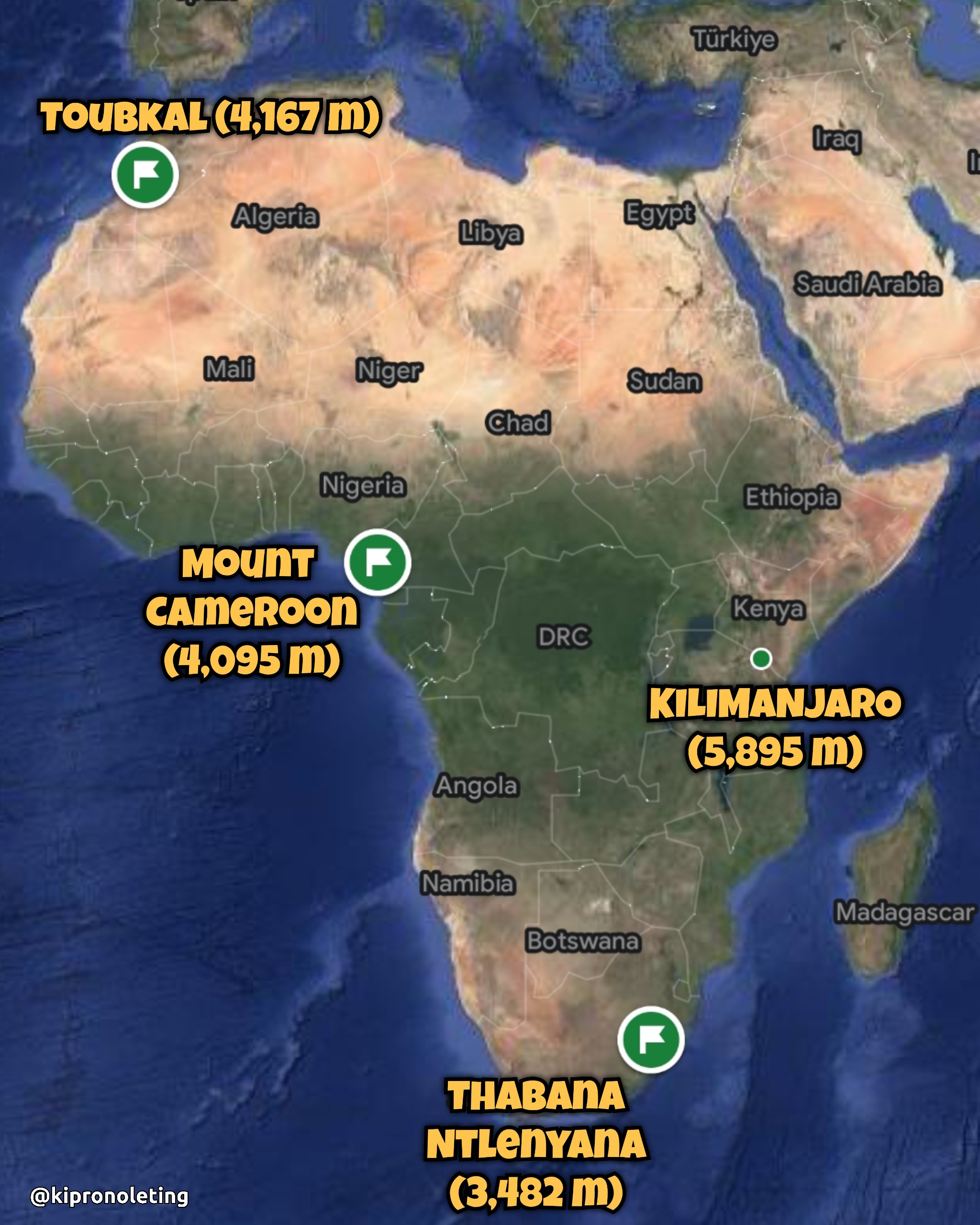
- Location: Mount Toubkal – Atlas Mountains, Morocco.
- Start & Finish Point: Imlil Village.
- Difficulty: Strenuous.
- Duration: 2 Days.
- Total Distance: 32 km.
- Min. Elevation: 1,738 m.
- Summit Elevation: 4,167 m.
- Total Elevation Gain: 2,500 m.
Highest mountain in North Africa. This was a summer hike.
Day 1: Base (1,738 m) to Toubkal Refuge (3,207 m)
– Distance: 12 km
– Time: 7 hrs
– Elevation Gain: 1,500 m
Hot day! Temperatures between 30°C-40°C.


Day 2: Refuge to Summit (4,167 m)
– Distance: 4 km
– Time: 3 hrs
– Elevation Gain: 1,000 m
Tough summit push. Very rocky terrain with scree. The summit night was a little chilly.
Day 2: Summit – Refuge – Base
– Distance: 16 km
– Time: 8 hrs
– Elevation Loss: 2,500 m


.
All in all, beautiful hike! I’ve now done the highest mountains in East, West, North and Southern Africa.